ISSO monitoring Station-600-601- GNSS
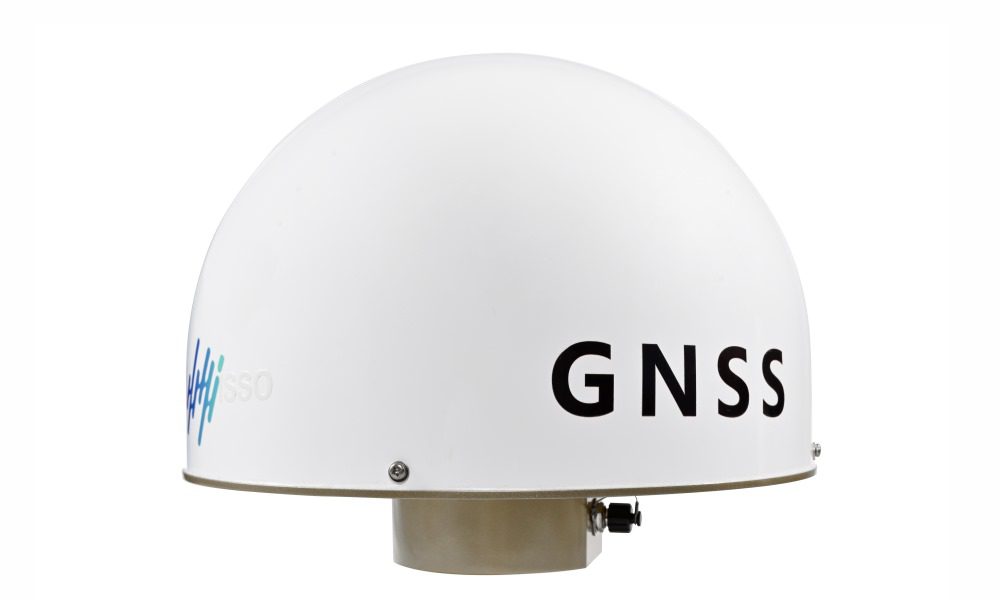
The ISSO 600-601–GNSS monitoring station is a highly accurate complex for ground-based tracking, reception and signal processing of global navigation satellite systems (GNSS). The main purpose of the system is to determine and continuously monitor spatial coordinates, velocity vector and accurate time by processing signals from satellite groupings GLONASS, GPS, BeiDou, Galileo, SBAS and QZSS. The complex functions as a fully functional reference station capable of operating both offline and as part of a network of permanent base stations (CORS), providing differential corrections and raw data to improve the positioning accuracy of external rovers.
The station is equipped with 440 tracking channels, which ensures simultaneous reception and processing of signals from all relevant satellite groupings.: GPS (L1, L2, L5), GLONASS (L1, L2), BeiDou (B1, B2, B3), as well as SBAS (WAAS, EGNOS, MSAS) and QZSS. This guarantees maximum satellite availability, increased noise immunity, and high accuracy in all conditions.
The complex is designed to operate in extreme conditions, which is confirmed by a wide range of operating temperatures from -40°C to +75°C and IP67 dust and moisture protection class.
Main characteristics of the ISSO monitoring station-600-601- GNSS
| Parameter | Meaning | |
| Model range | 600-601-GNSS | 600-606-GNSS |
| Dimensions, mm | Ø230 mm | Ø230 mm |
| Monitored channels | 440 channels GPS: L1, L2, L5 GLONASS: L1, L2 BDS: B1, B2, B3 SBAS: WAAS, EGNOS, MSAS |
1408 channels GPS: L1, L2, L5, GLONASS: L1, L2 BDS: B1C, B2A, B1I, B2I, B3I GAL: E1, E5a, E5b QZSS: L1, L2, L5, QZSS: L1, L2, L5 |
| Measurement accuracy | Accuracy of static measurements The plane: ± (2,5 + 0,5 * 10-6D) mm Height: ± (5,0 + 0,5 * 10-6D) mm Accuracy of dynamic measurements The plane: ± (8 + 1 * 10-6D) mm Height: ± (15 + 1 * 10-6D) mm Reliability of initialization: > 99,9 % Initialization time: 10 с Time Accuracy (RMS): 20ns Speed accuracy (RMS): 0,2m/s |
Accuracy of static measurements The plane: ± (2,5 + 0,5 * 10-6D) mm Height: ± (5,0 + 0,5 * 10-6D) mm Accuracy of dynamic measurements The plane: ± (8 + 1 * 10-6D) mm Height: ± (15 + 1 * 10-6D) mm Reliability of initialization: >99,9 % Initialization time: ≤20s Time Accuracy (RMS): 20ns Speed accuracy (RMS): 0,2m/s |
| Input/output data format | Differential communication: CMR, CMR +, SCMRx, rTCM 2.3, RTCM 3.0, RTCM 3.1, RTCM 3.2, RTD Positioning data: NMEA-0183 V2.30 Built-in data storage: 32GB |
Differential communication: RTCM3.2, RTCM3.x Positioning data: NMEA-0183 V2.30 Built-in data storage: 32GB |
| Data transmission | Supports full duplex 10/100Base-T Mb/s Supports HTTP, TCP/IP, UDP, FTP, NTRIP Caster, NTRIP Server, NTRIP Client, HTTPS protocol Supports multiple data streams sent simultaneously Outgoing frequency: 1Hz, 2Hz, 5Hz, 10Hz, 20Hz, 50Hz Data transmission network: 4G |
Supports TCP/IP, MQTT, NTRIP Server, HTTPS protocol Supports multiple data streams sent simultaneously Outgoing frequency: up to 20 Hz Data transmission network: 4G |
| User interfaces | 4 diode indicators, 7–button keyboard LCD display WEB interface | 4 diode indicators, 1 Nano SIM Card slot 1 10–pin Lemo connector 1 TNC interface, 1 RJ45 interface |
| Power supply | Supports DC voltage of 9–36V The power consumption of the main unit is 3 watts Built-in galvanic isolation Supports automatic power -on after power supply is restored | DC 12V, supports DC 9–18V voltage Main unit power consumption <1,5 W Built-in galvanic isolation Supports automatic power-on after power supply is restored |
| Physical tests | Operating temperature: from -40 to +75 °C Storage temperature: from -40 to +85 °C Dust and moisture protection: IP67 Humidity: 100% relative humidity without condensation | Operating temperature: from -40 to +75 °C Storage temperature: from -40 to +85 °C Dust and moisture protection: IP68 Humidity: 0-99% relative humidity without condensation |
ISSO monitoring Station-600-601- GNSS is used in systems


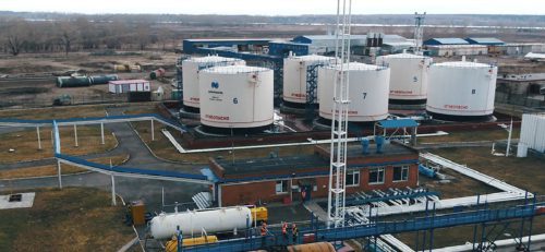
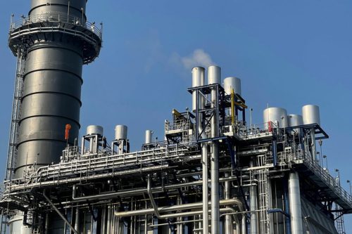


In which projects was it used


- office 408, 4, lit. K, Fuchika St., St. Petersburg, 192102, Russia
- +7 (812) 775-10-82
- office@ntc-ksm.ru
- Opening hours: Mon-Fry с 9:00 AM до 06:00 PM MSK